
Five days on foot along the volcanic coasts of San Pietro Island and the mining coast of Sulcis, between Nebida and Buggerru, in the Geomineral Park of Sardinia.
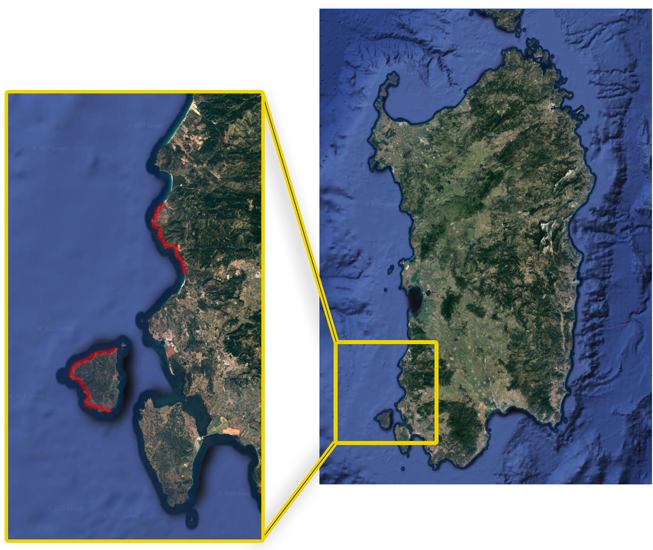
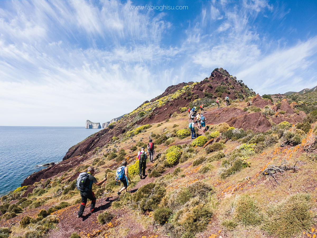
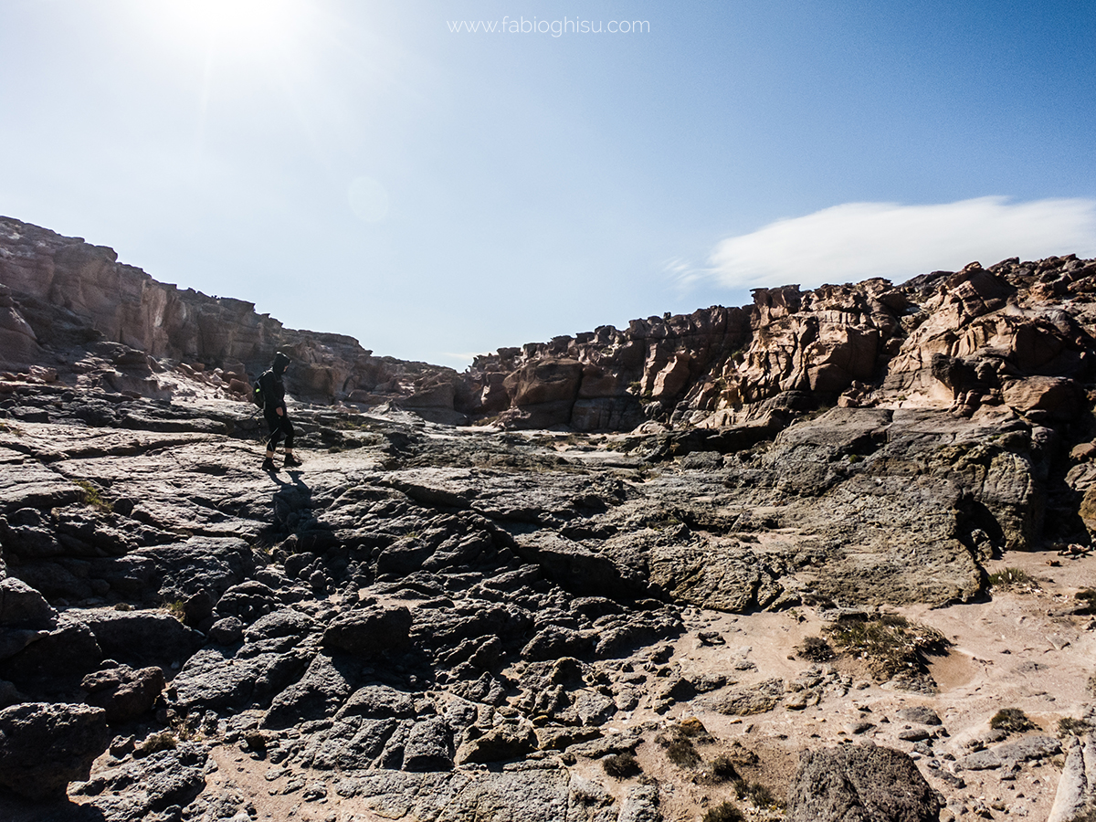
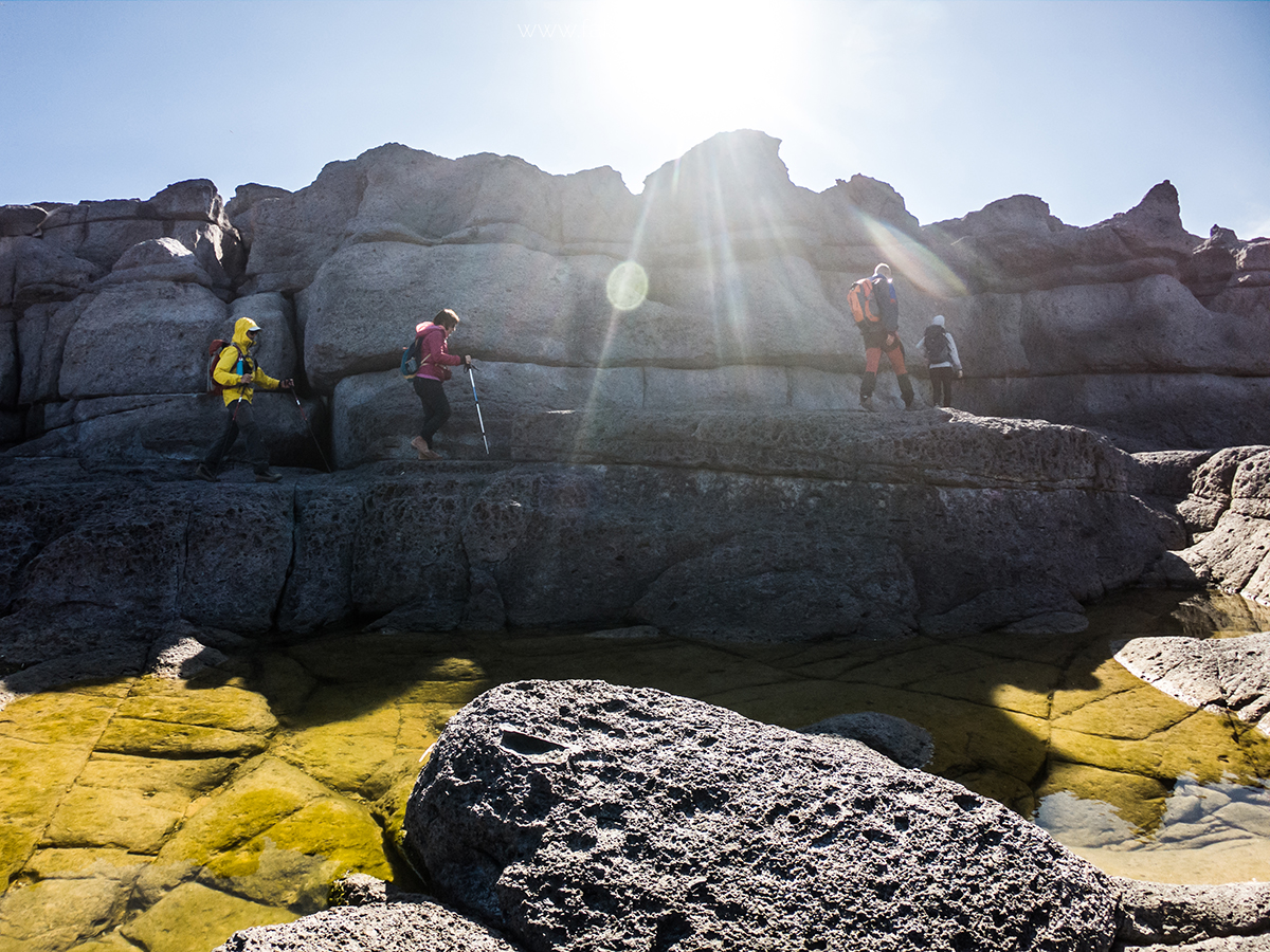
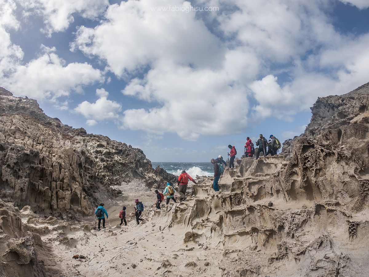
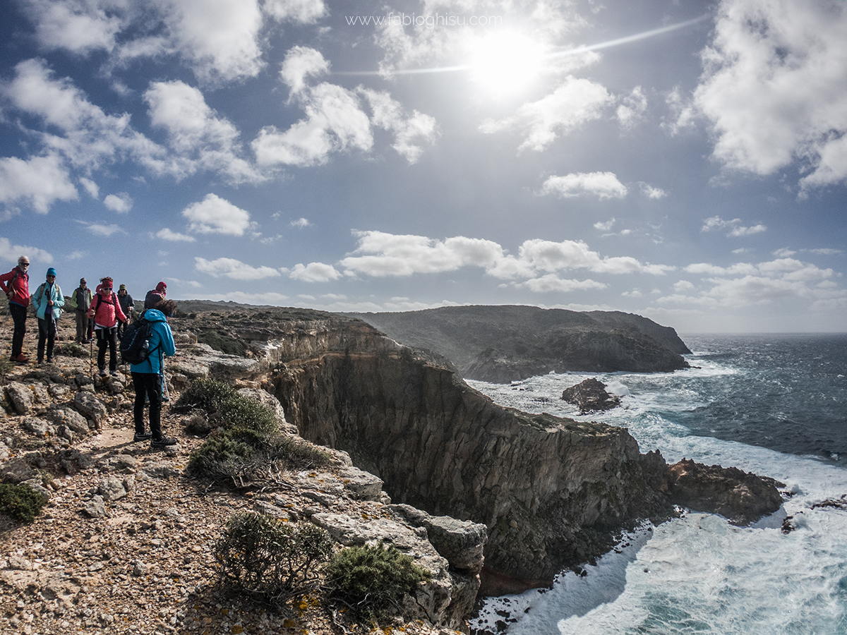
This trek takes you through some of the most suggestive and characteristic places of Sulcis. San Pietro Island is surrounded by volcanic rock, making its coasts rugged and wild, full of natural monuments and wonderful cliffs, ideal for trekking. The limestone and dolomitic coast between Nebida and Buggerru is one of Sardinia's most famous hiking spots, featuring the "Miniere nel Blu" trail, where history and industrial archaeology meet lush and spectacular nature. This is a five-day trek of medium difficulty, with several challenging sections that require some training and experience.
Check the calendar to see if it's scheduled (Click here!)
Main Points of Interest Along the Trek
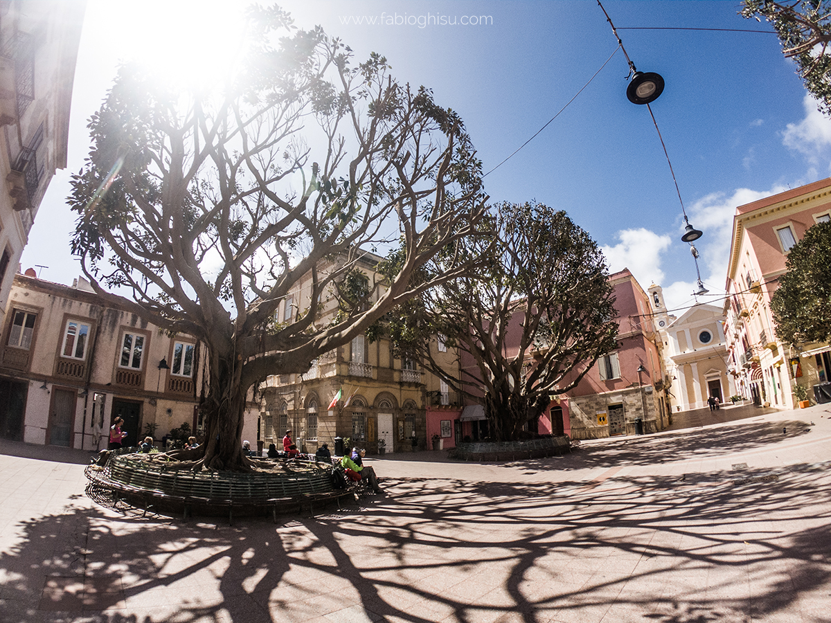
Carloforte
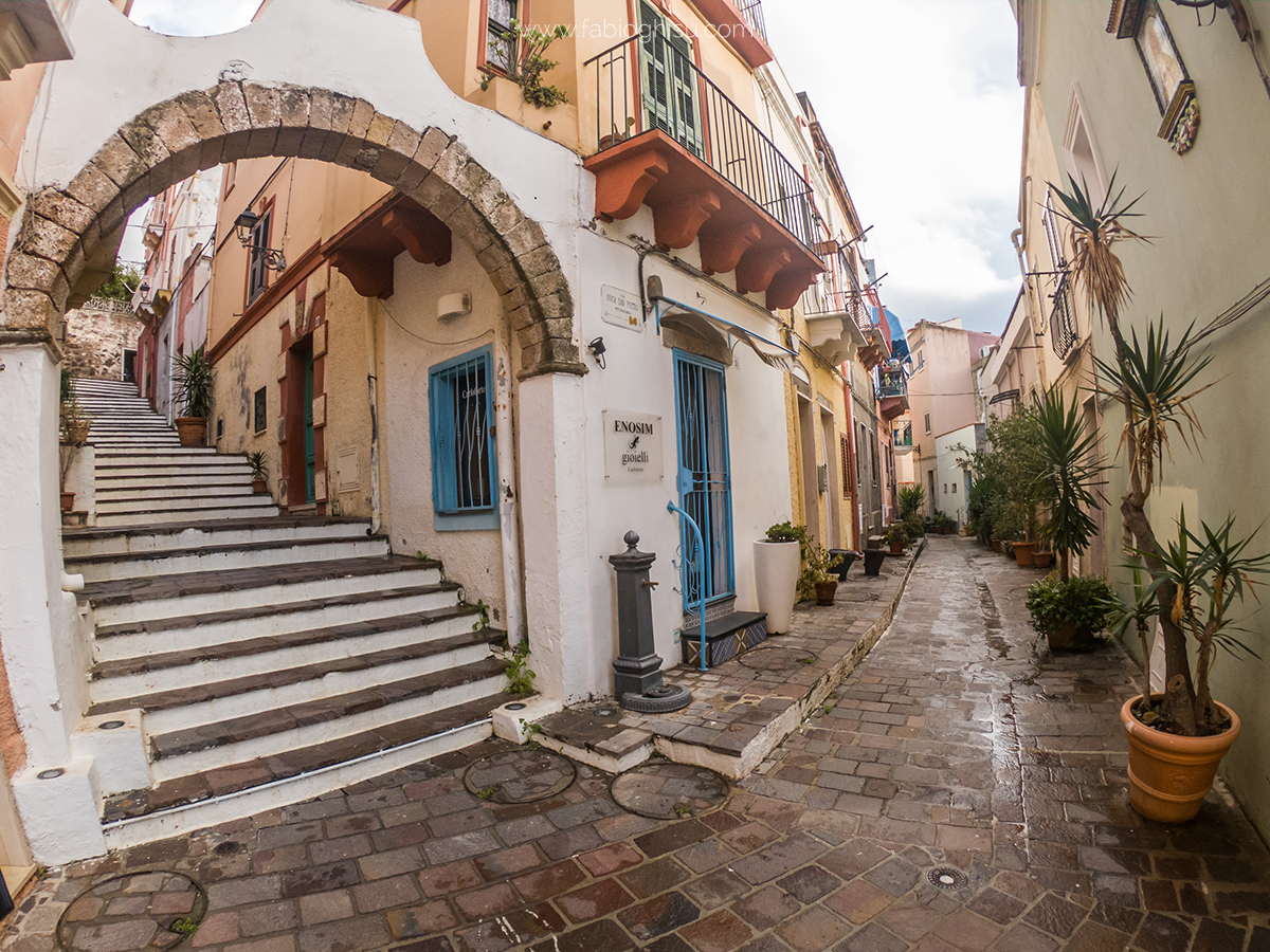
Carloforte is a delightful town, the only inhabited center on San Pietro Island. A unique place where its inhabitants are of Ligurian origin. The language spoken is an ancient Genoese dialect that the locals carefully preserve since they colonized the island in 1738. The Carlofortini are called "Tabarchini" because before moving to San Pietro Island, they lived on another island, Tabarca, off the coast of Tunisia. The local cuisine includes couscous, chickpea flatbread (fainò), and Genoese pesto. The town is also famous for its bluefin tuna, as it is home to one of the last working tuna fisheries in the Mediterranean.
The Coast of San Pietro Island
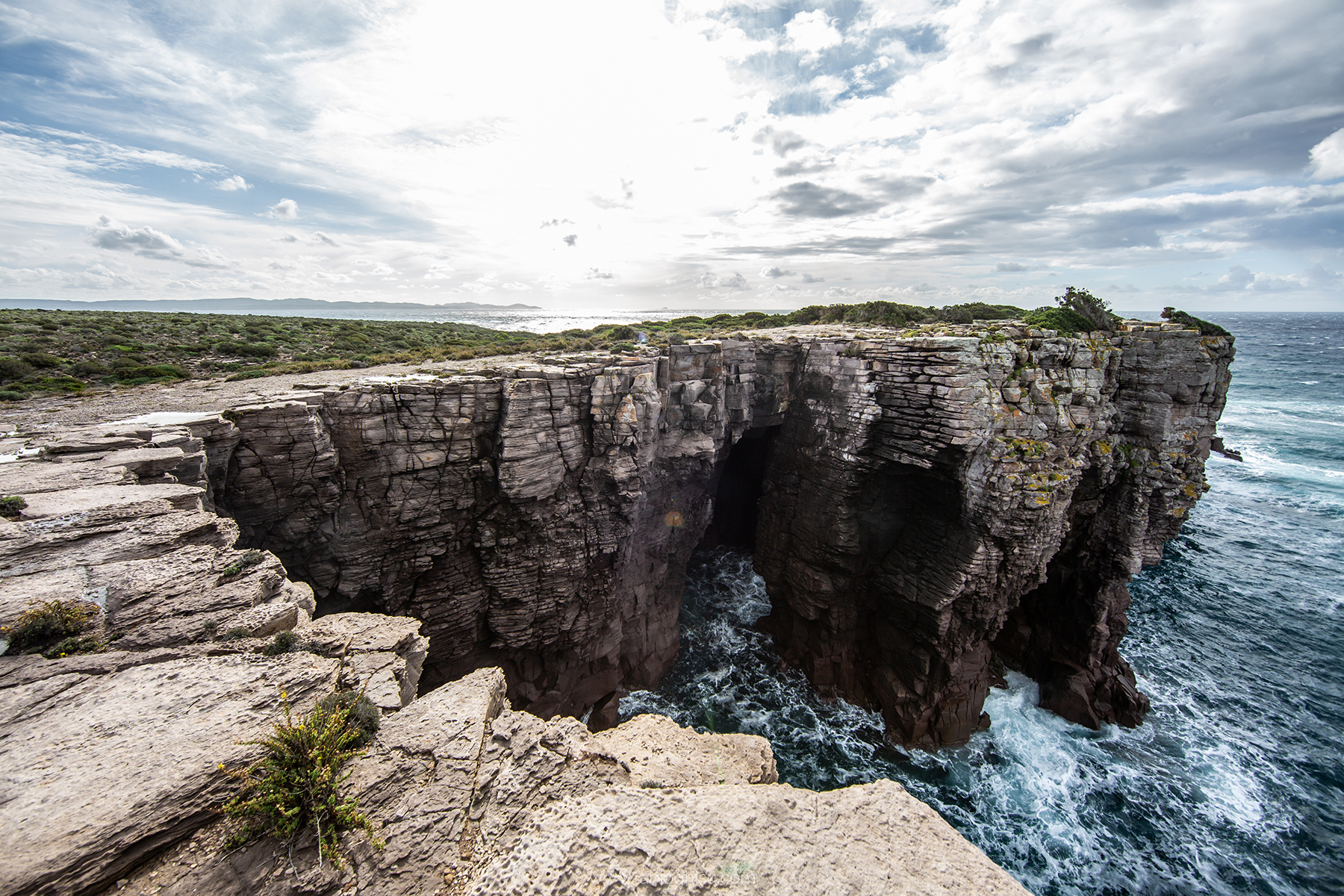
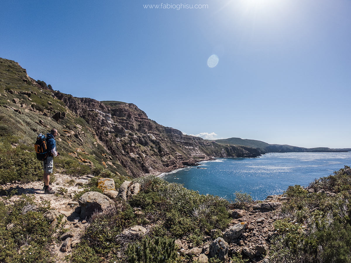
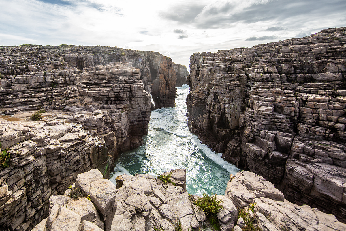
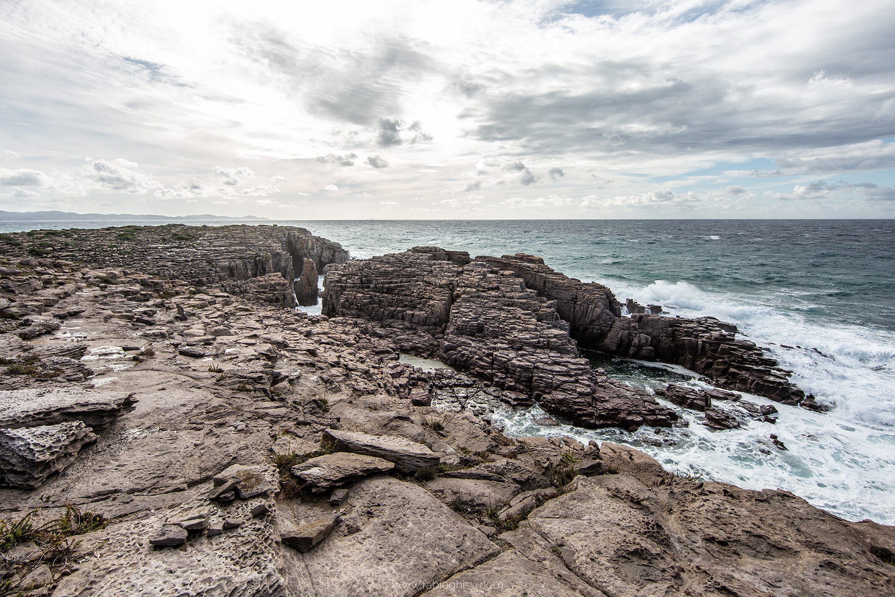
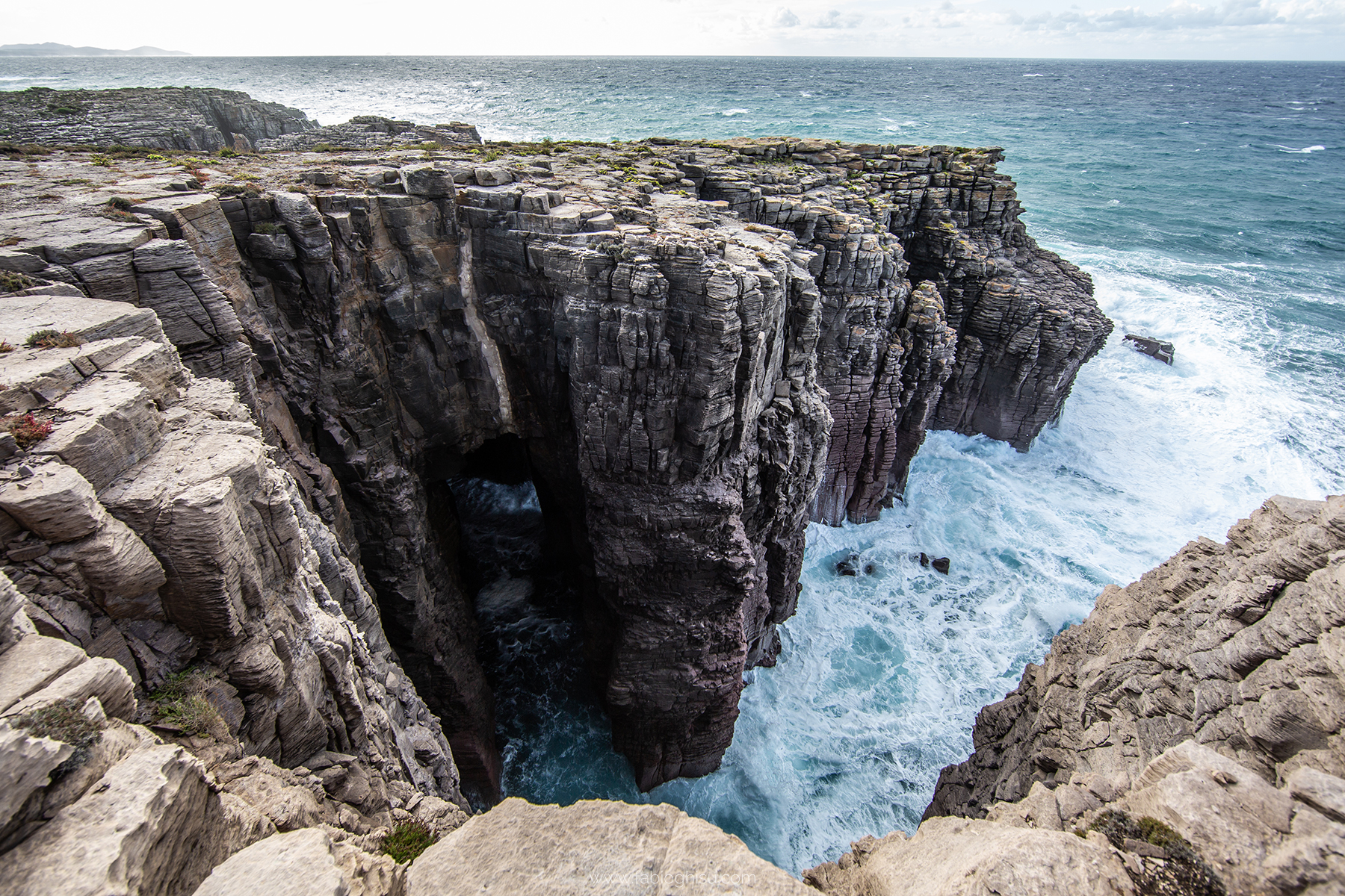
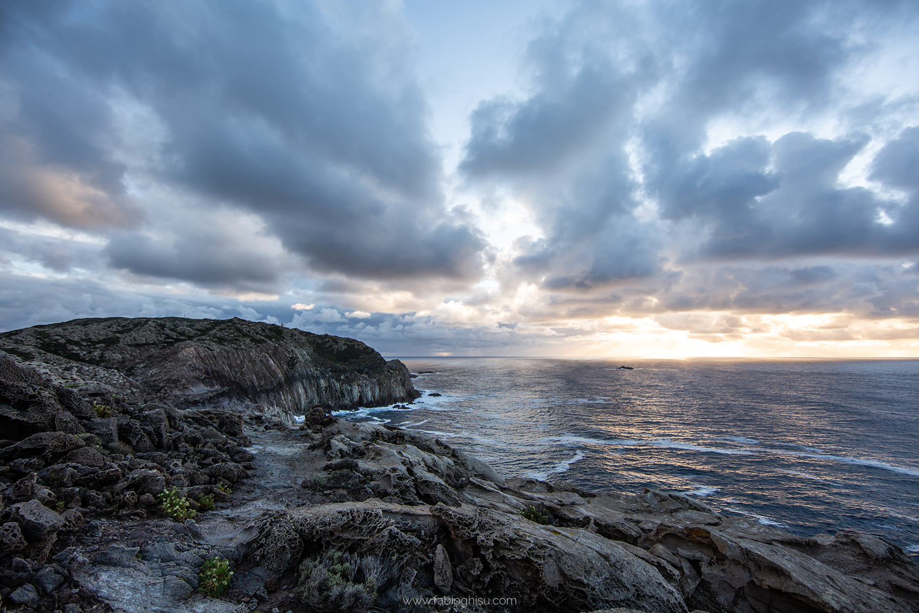
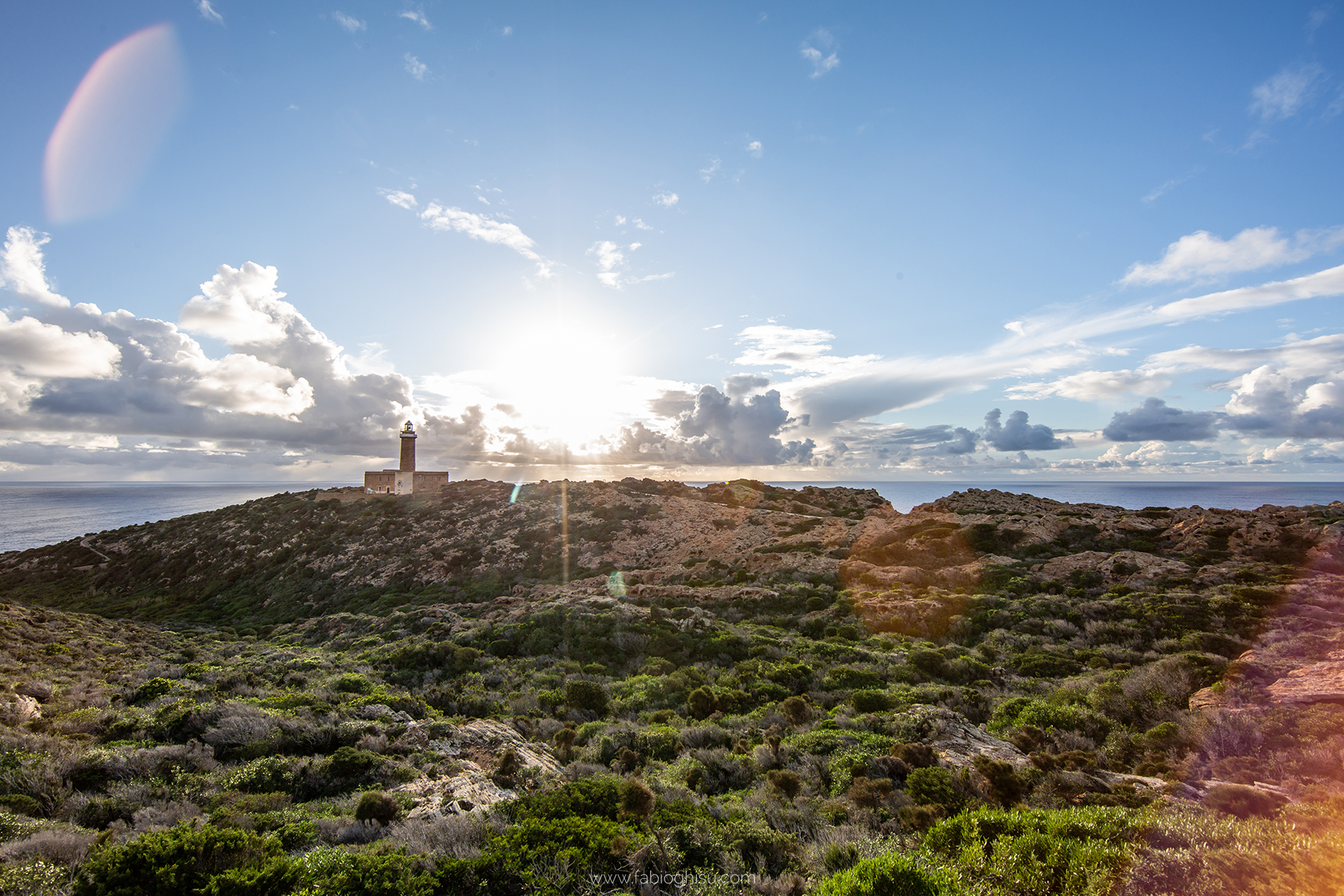
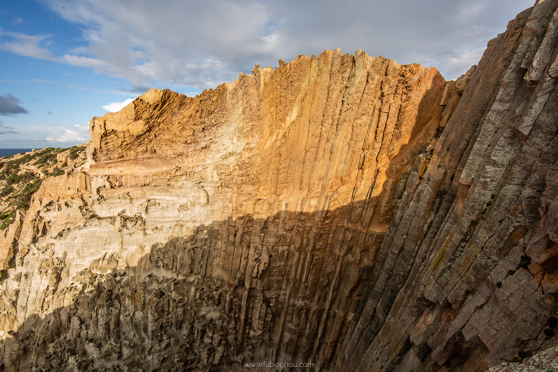
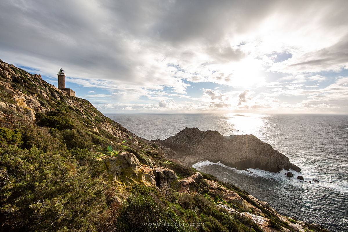
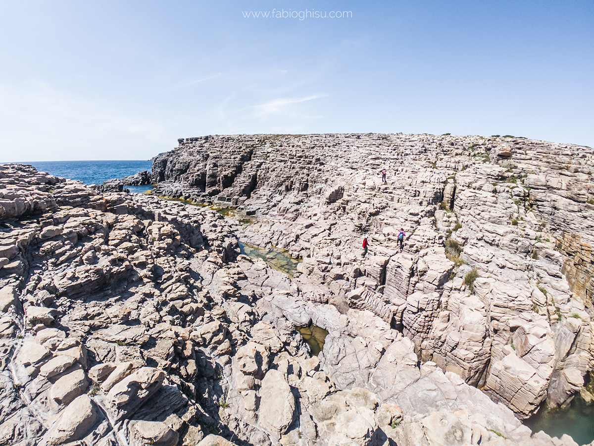
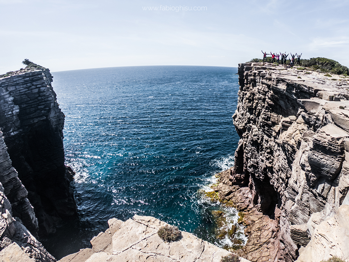
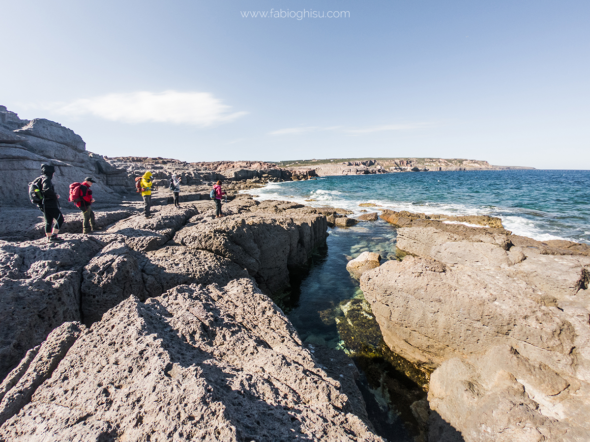
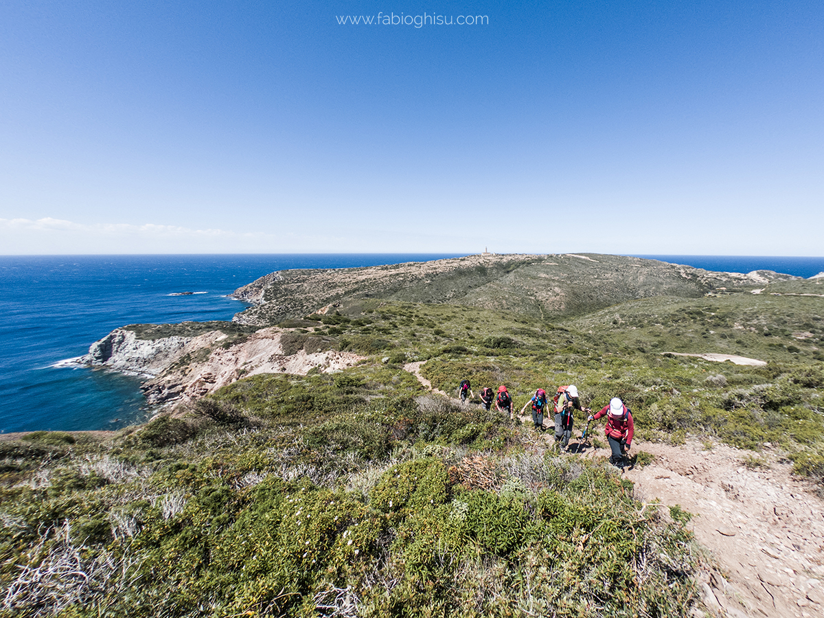
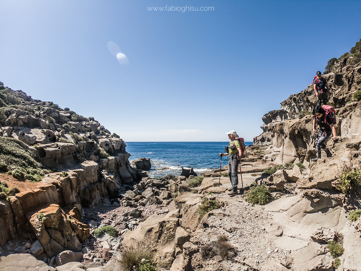
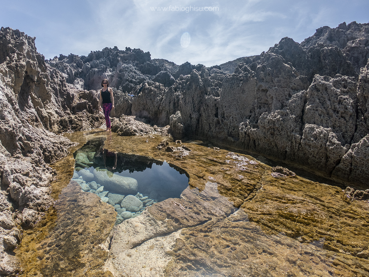
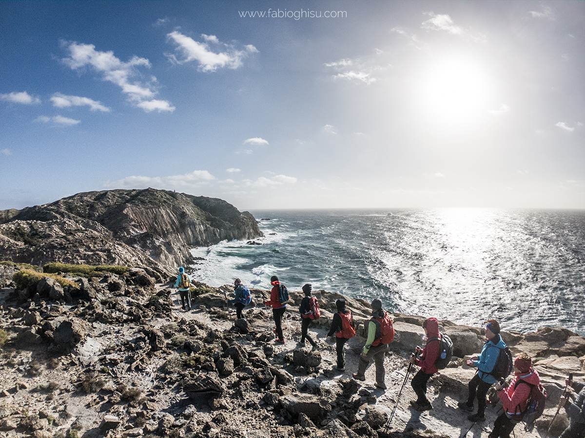
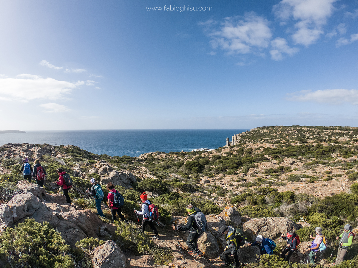
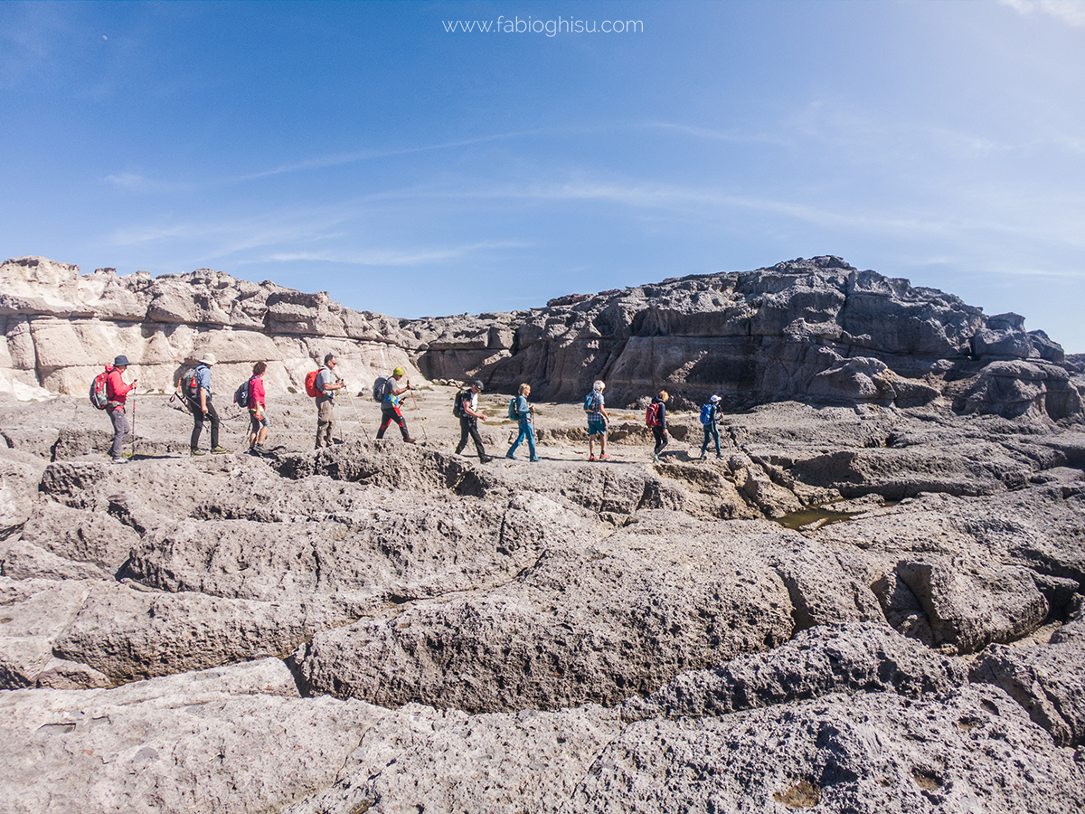
The island is lined with jagged cliffs plunging into the sea from heights of up to 150 meters. The rugged cliffs alternate between rocky outcrops and sheltered coves with pristine beaches. To the north, Cala Vinagra offers a romantic panorama with pebbles descending into emerald waters. To the northwest, a deep fjord leads into the rocks to a charming small beach known as Cala Fico. Further west, the highest point of the island, Capo Sandalo, is dominated by a 19th-century lighthouse, the westernmost in Italy. From the top, you feel suspended between sky and sea. Just offshore lies the small Corno Island, a prime destination for diving and sport fishing due to its abundant marine life.
Sharp cliffs serve as a refuge for peregrine falcons and Audouin's gulls, as well as the rare Eleonora's falcon, which nests in the cliffs of Cala Fico, an area protected by the LIPU for conservation. In the salt marshes, you can spot flamingos, black-winged stilts, little terns, and egrets.
Nebida and the Laveria
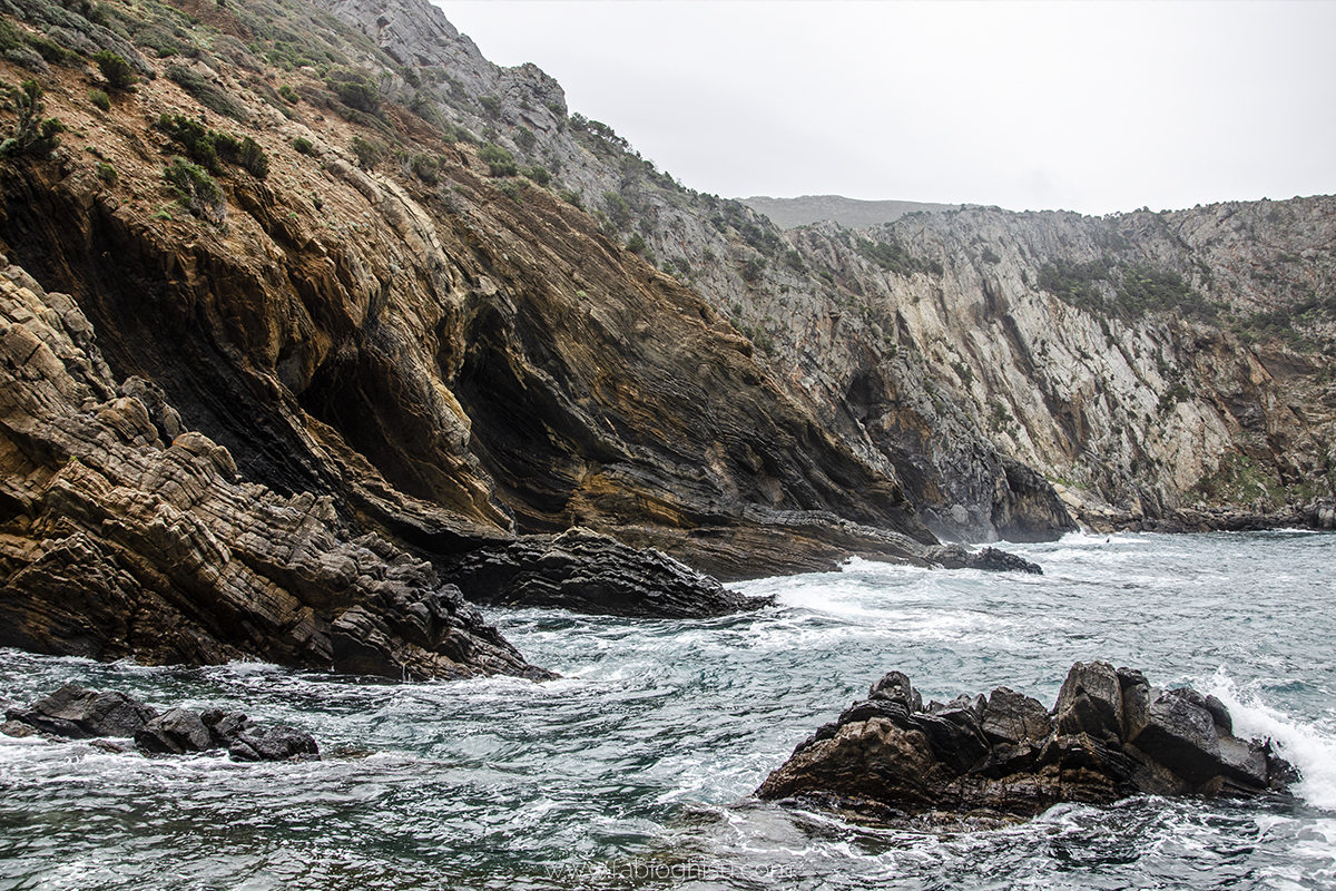
Nebida is a former mining village in Sulcis-Iglesiente, now a picturesque tourist destination on Sardinia’s southwestern coast. Its brick and stone washing plant overlooks the Masua coast, offering stunning views, including the famous sea stack Pan di Zucchero, visible from a scenic walkway. The remnants of the old lead-zinc mine of Nebida, a district of Iglesias located 15 km away, include the majestic seafront ore washing plant, the administrative office building, and the small mining village. This is one of the most fascinating sites of industrial archaeology in the entire island and an integral part of Sardinia’s Geomineral Park, a UNESCO-recognized heritage site.
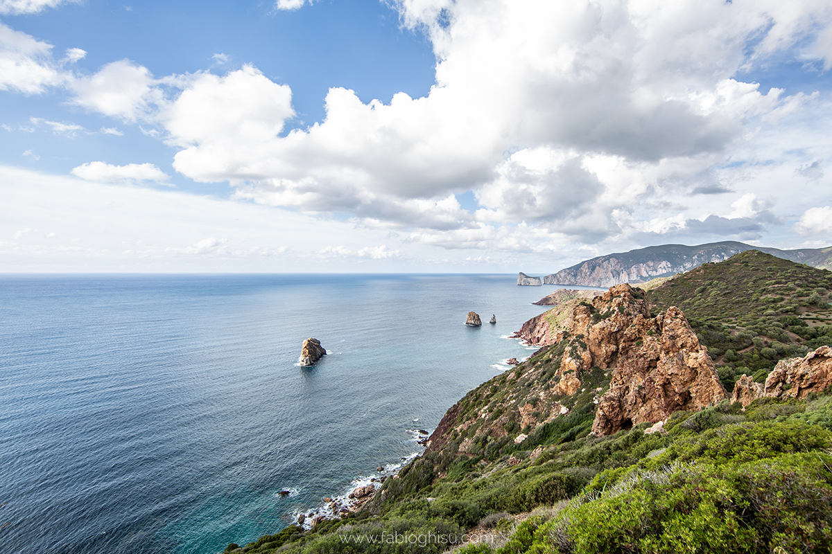
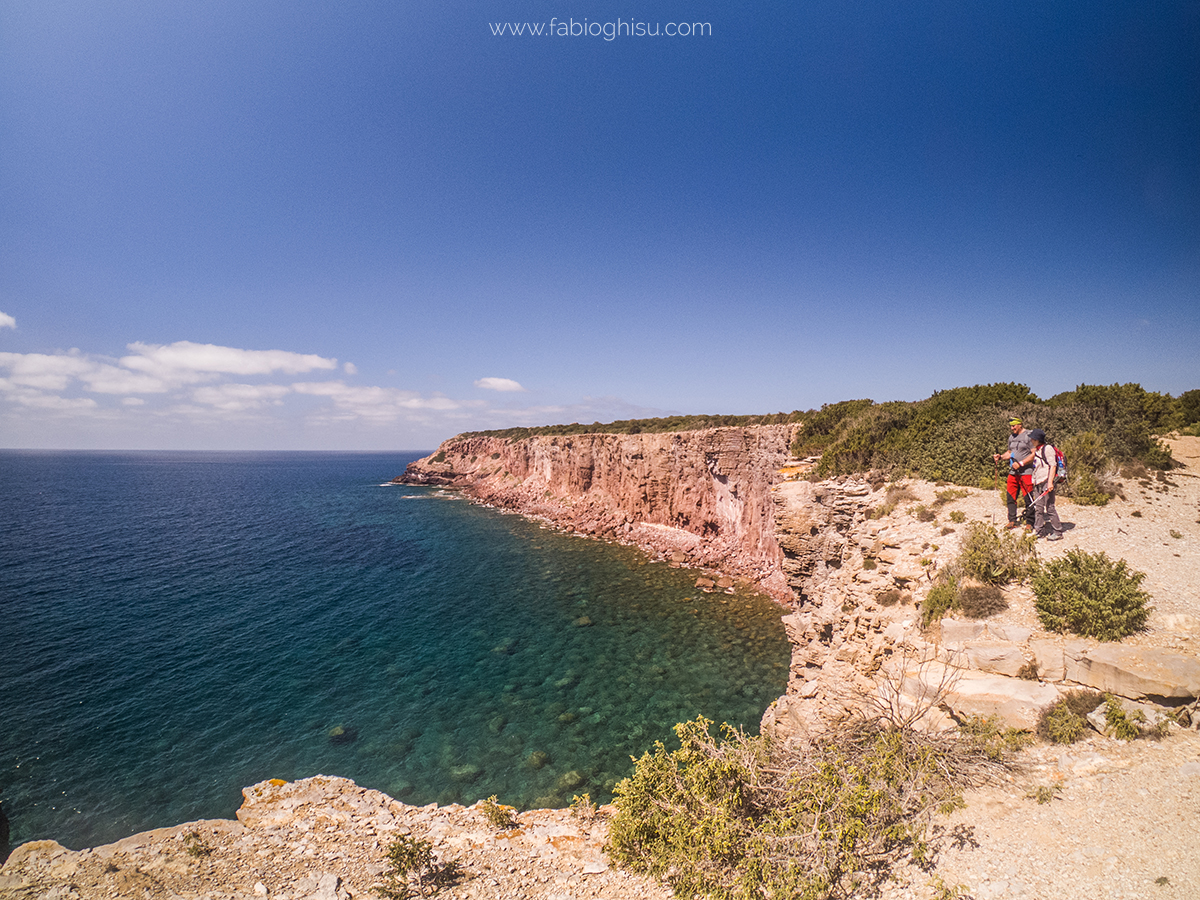
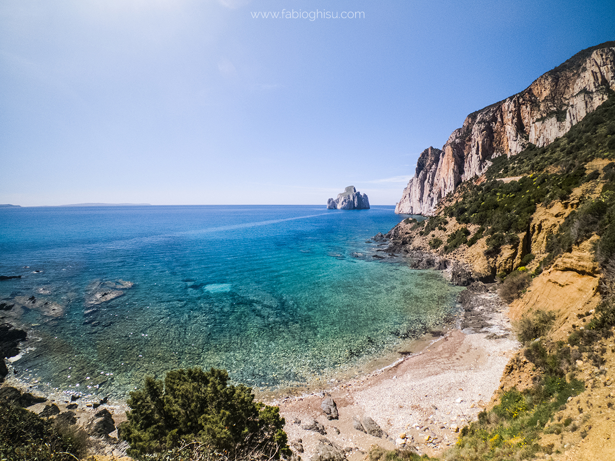
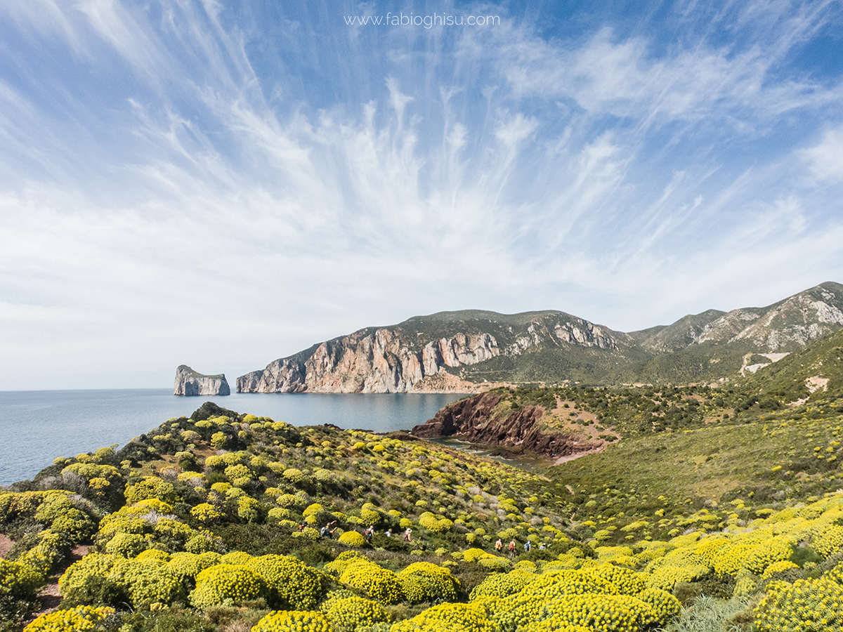
Pan di Zucchero
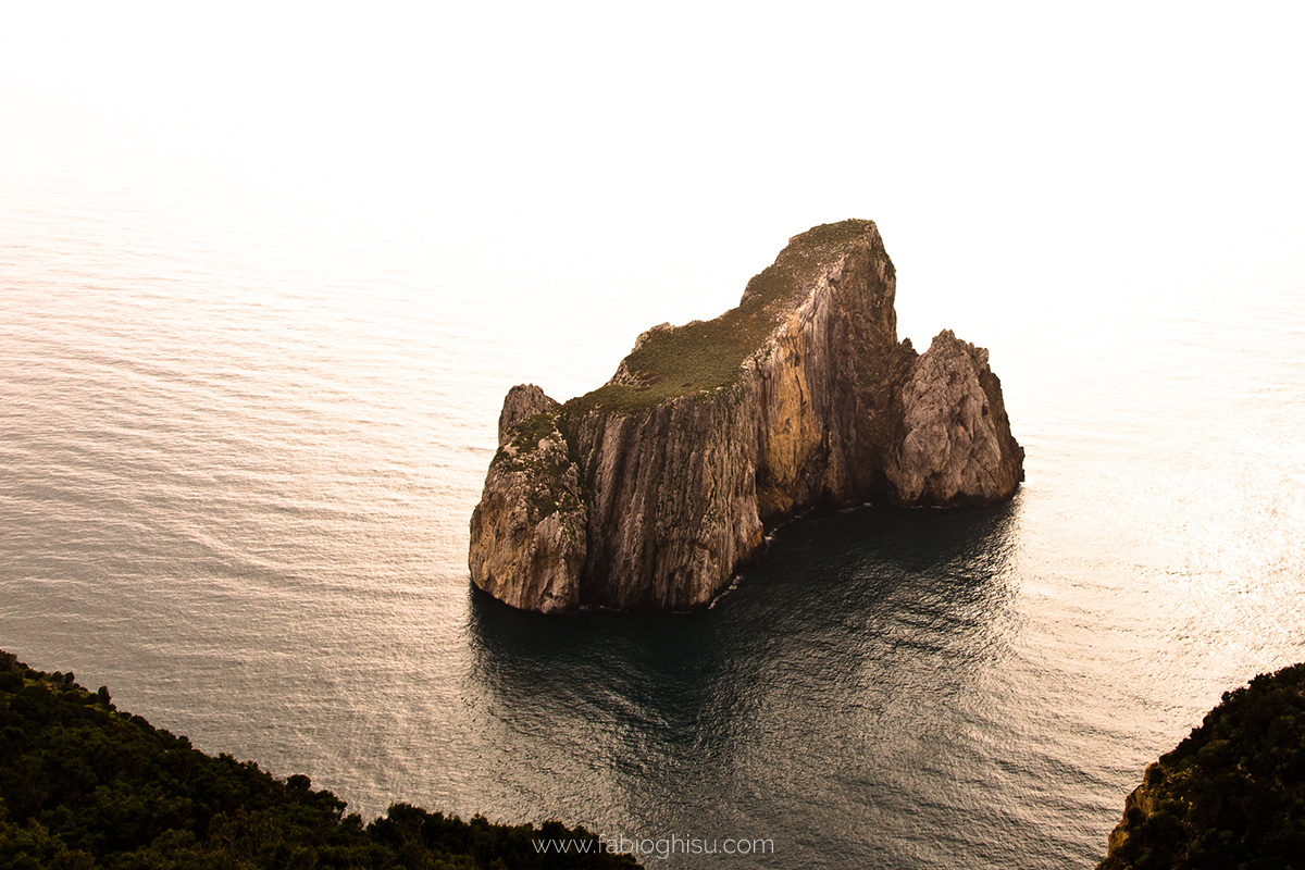
Pan di Zucchero is a sea stack rising from the sea near Masua. It is one of the most imposing and spectacular natural monuments on the island, symbolizing the Iglesias coastline. Standing at 133 meters, it is the tallest sea stack in the Mediterranean. Four other structurally connected sea stacks accompany it, forming part of the monument. Their white-blue color contrasts sharply with the purple-tinged coastline. Composed of Cambrian limestone, they were separated from the mainland by marine erosion, precisely from the cliffs of Punta is Cicalas, where a 300-meter stretch of sea now separates them.
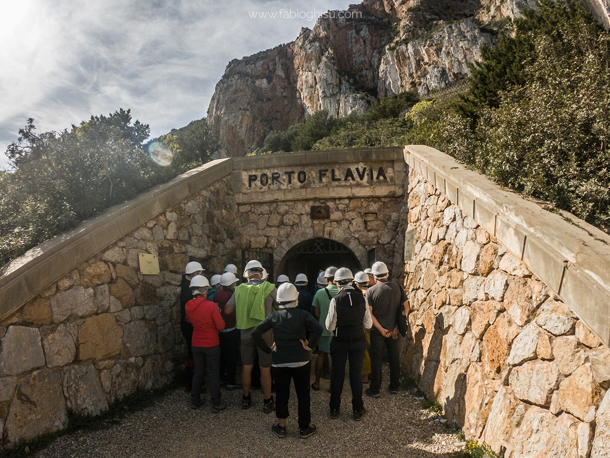
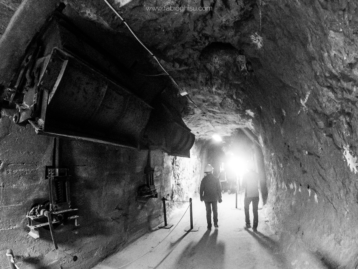
Porto Flavia
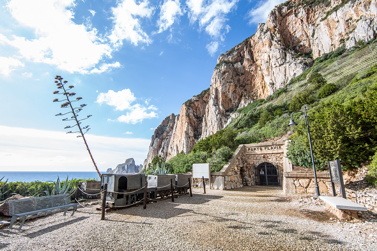
A 600-meter-long tunnel, carved into the rock by miners, emerges halfway up a cliff, offering breathtaking views of the stunning Pan di Zucchero sea stack. Porto Flavia, inside the promontory overlooking Masua in Iglesias territory, was built between 1922 and 1924. It was an engineering marvel, allowing minerals to be directly loaded onto ships bound for Northern European foundries, drastically reducing transport time and costs.
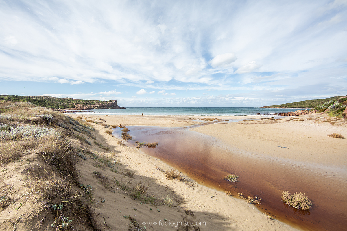
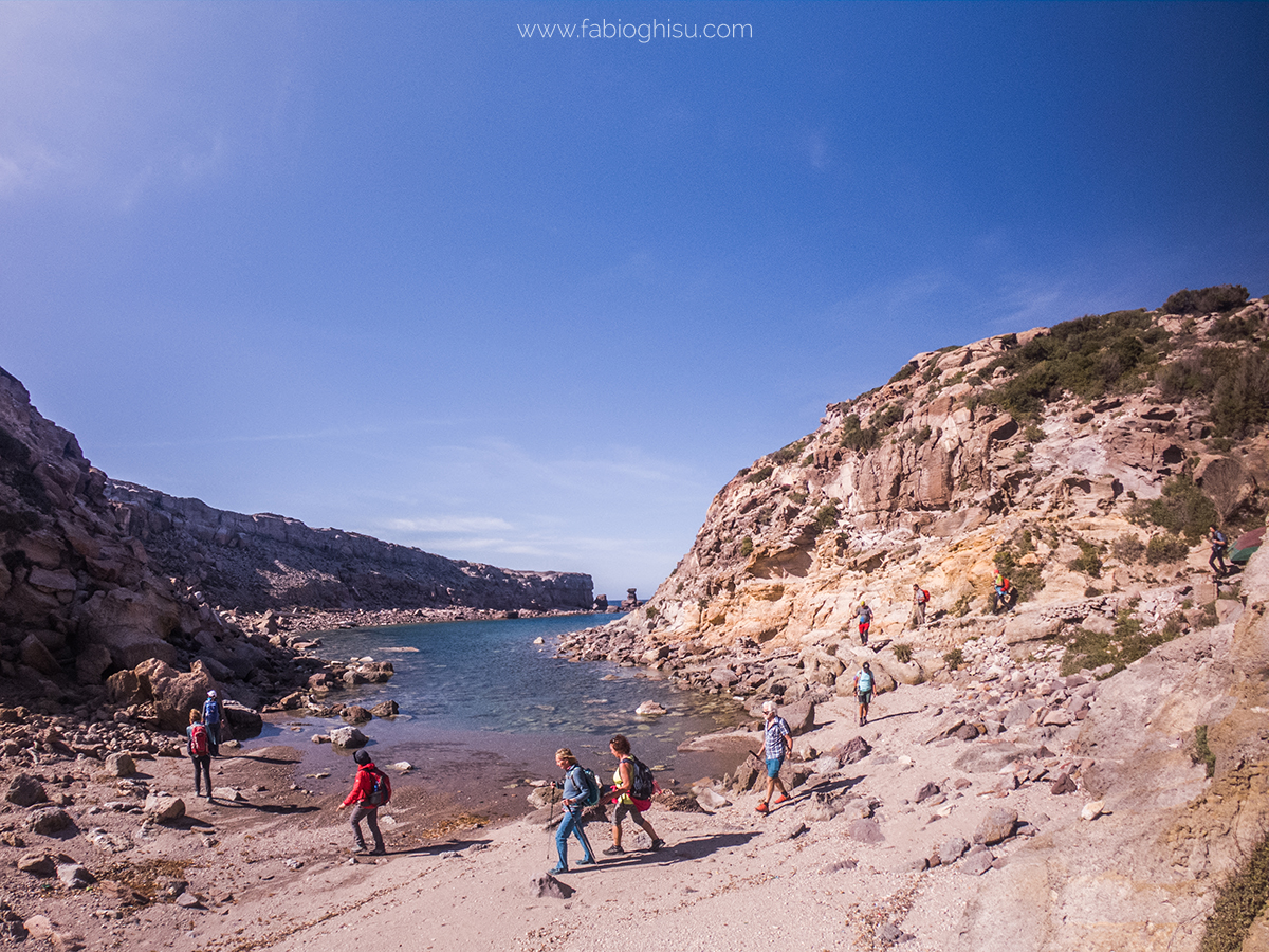
Cala Domestica
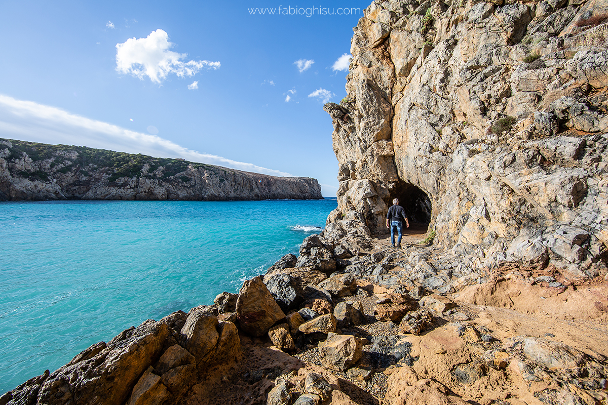
Until 1940, minerals extracted from the mines were shipped from here. Like an open-air industrial archaeology museum, Cala Domestica, south of Buggerru, two kilometers away, preserves ruins of warehouses, depots, and tunnels dug by miners. One of these, on the right side of the cove, leads to a second secluded and almost intimate little cove, aptly named La Caletta.
The main cove is a deep and delightful inlet, almost like a fjord, with a wide and sheltered sandy beach in shades of white, amber, and gold, soft and compact. Small Mediterranean scrub shrubs sprout on the dunes behind the sandy stretch. In front, you can admire one of the most beautiful seas in Sardinia, with turquoise and blue hues.
Check the calendar to see if it is scheduled (Click here!)
Trekking Stages
First Stage - Nasca and Capo Sandalo
Route Length: 10 km
Duration: 4h30min
Elevation gain: 245 m
Difficulty: medium
Possibility to exit early with shuttle service: yes
Second Stage - From Capo Sandalo to La Caletta
Route Length: 10 km
Duration: 6h
Elevation gain: 500 m
Difficulty: medium
Possibility to exit early with shuttle service: no
Third Stage - From La Caletta to Geniò Beach
Route Length: 8 km
Duration: 4h
Elevation gain: 100 m
Difficulty: medium
Possibility to exit early with shuttle service: yes
Fourth Stage - From Nebida to Masua
Route Length: 8 km
Duration: 4h
Elevation gain: 345 m
Difficulty: medium
Possibility to exit early with shuttle service: no
Fifth Stage - From Masua to Cala Domestica
Route Length: 11 km
Duration: 8h
Elevation gain: 650 m
Difficulty: challenging
Possibility to exit early with shuttle service: no
Organizational Details
Number of guides required: 1 guide for 1-8 participants, 2 guides for 9-16 participants
Number of shuttles required: 1 shuttle for 1-8 participants, 2 shuttles for 9-16 participants
Reference airport: Cagliari
Check the calendar to see if it is scheduled (Click here!)
A few more images:
Photos by: Fabio Ghisu
Text Source: Sardegna Turismo and Wikipedia